Every cloud has a silver lining
Every cloud has a silver lining
By Peter Hollingsworth

The subject of the weather is always high on the agenda of most groundsmen and greenkeepers. Not a day passes without some reference to the weather. A dramatic change can severely influence the condition and performance of the playing surfaces.
Monitoring the weather in the 21st century, whilst not an exact science, is fairly straightforward. The modern turfcare professional has, at his disposal, the latest technology and equipment to predict the weather fairly accurately, allowing greater control of irrigation systems, fertiliser application and other tasks.
Back in the 'old days' those working outdoors seemed to have an affinity with the weather - a subconsciously feel for it - and could generally second guess the onset of a change. Apart from aching joints, cows lying down or your seaweed getting moist, recognising cloud formations was the key.
So, even in these technically advanced times of satellites, computers and weather stations, just a simple glance skywards can still provide a good indication of what might be heading your way!

|
|
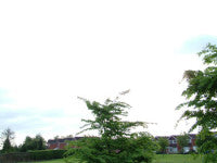
Cumulus of the fair weather variety. This type of cloud is normally associated with a gentle westerly flow over the country having picked up a small amount of moisture while passing over the ocean, thermal activity (convection) causes small Cumulus type clouds with very little vertical extent, these clouds will often be welcomed when the weather is hot as they offer some occasional shade, but they are very unlikely to build into large Cumulus or Cumulus Nimbus clouds and therefore the weather is likely to remain dry.
|
|
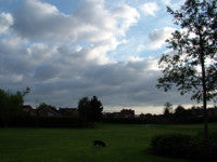
| Stratus. This is a veil of stratus cloud, often a feature associated with a warm front, in this photo, the stratus is very bright suggesting that it is of little vertical extent and also suggesting that there is little other cloud above it, therefore, although there is possibly some rain associated with this cloud, it is likely to be light and in the form of drizzle. |
|
|
Cumulus of the fair weather variety, but building to some extent, possible growth and therefore showers later in the day.
|

|
|
Cumulus showing some vertical extent, could grow to cause some showery activity later.
|
|
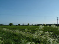
| Fair weather day, however there is a small line of Cumulus cloud in the distance suggesting some convective activity. |
|
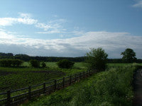
| The presence of Cirrus, Alto-cumulus and Strato-cumulus suggests that a warm front is on its way, the layering of cloud is driven by the "slope" of a warm front, high level cloud would typically be seen first, followed by progressively lower levels of cloud. Rain, thicker cloud and more dull weather is the likely scenario in the hours ahead of this photo being taken. |
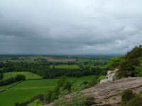
|
| Large Cumulus or even Cumulus-Nimbus clouds very well developed and showers can clearly be seen in the distance, the dark striations beneath the clouds are rain drops. Often these can be seen falling beneath the clouds, but not actually reaching the ground, this is caused by evapouration as the rain falls towards the ground. These situations are often seen either as a trough passes over, or after the passage of a cold front. |
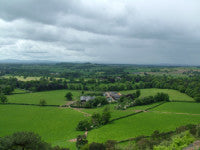
|
| Large Cumulus and Cumulus-Nimbus clouds and showers, however a brighter area to the left of the picture suggests that this is the back edge of a showery area behind either a trough or a cold front. Fairer weather is likely to be on its way. |
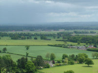
|
|
Cumulus-Nimbus cloud producing a heavy downpour in the distance.
|

|
|
Well developed large Cumulus or small Cumulus-Nimbus clouds. No rain can be seen in this photo, but these clouds are showing signs of growing and showers are almost certain to follow fairly soon afterwards.
|
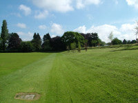
|
|
Cumulus developing, fair weather at the moment, but watch out for showers in the next few hours.
|
|
|
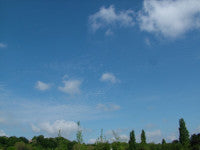
Cirrus, Alto-cumulus and small cumulus, clouds are associated with the passage of a cold front, watch out for development of the cumulus and possible showers.
|
Peter Hollingsworth
Metra Information Limited
Wolverhampton Science Park
Wolvehampton
WV10 9RU
